In today’s shipping world, modern navigation, port operations, cargo tracking, and numerous communications and automation systems all depend on satellite signals, making them a high-value target in strategic competition. Nation-states use jamming and increasingly accessible spoofing tools to hide movements, disrupt military systems, and deny precision effects, while non-state actors exploit cheap jammers and Automatic Identification System (AIS) spoofing for theft, illegal fishing, sanctions evasion, and opportunistic disruption.

The result is a low-cost, high-impact threat as modest investments in jammers or spoofers can disrupt contested coasts, chokepoints, and busy maritime corridors. Global Navigation Satellite System (GNSS) disruption is no longer theoretical. In the Strait of Hormuz, GPS jamming was reported to have affected over 1,600 vessels in a single day, while Finland’s Coast Guard has tracked persistent interference and AIS spoofing in the Baltic since 2024, including tankers masking port calls in Russia. In the Black Sea and near Crimea, ships have appeared to “sail” across airports, complicating logistics and search-and-rescue operations. Even in calmer waters, GPS or AIS failures in the Baltic and Danish Straits have caused operational delays.

This growing interference has sparked international attention. In March 2025, the International Maritime Organization (IMO), International Civil Aviation Organization (ICAO), and International Telecommunication Union (ITU) issued a rare joint call urging protection of vital radio frequencies and curbs on electronic warfare at sea. Insurers and operators now face higher war-risk premiums, compliance checks, and costly data verification in contested regions.

Traditional navigation skills remain an essential safeguard as the maritime industry confronts the risks of spoofing and jamming. © BSM
While electronic navigation systems are central to modern navigation, they can also present vulnerabilities.
How interference can affect ship systems

Often, disruption on board begins subtly with a chime on the bridge, followed by a warning on the Electronic Chart Display and Information System (ECDIS): Position lost. GPS coordinates freeze, radar overlays misalign, and other sensors provide conflicting data. Jamming strips away the GNSS fix in seconds; spoofing is subtler, producing drifting positions or inaccurate time stamps. The instruments remain illuminated, but their information is untrustworthy.

“When I'm walking along the beach promenade in Limassol in the morning and my smartwatch tells me that I'm at Beirut airport, it's just a minor inconvenience. But when I'm standing on the bridge of a ship and four alarms go off at once, I really have to be able to keep a cool head,” explained Nicholas Rich, Director of Fleet Management at Bernhard Schulte Shipmanagement (BSM).

At sea, GNSS underpins navigation, communication timestamps, AIS, and port coordination. When it fails near coasts, traffic lanes, or harbour approaches, the margin for error collapses. In such a scenario, crew must revert to visual and radar position fixing as well as heightened vigilance.

The human factor

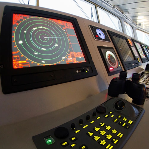
While GNSS technologies have revolutionized the maritime industry, they are far from the first tools used for navigation at sea. For centuries, sailors relied on celestial navigation, using the stars, sun, and moon to chart their course. In more recent times, radar, radio signals, and compass systems played vital roles in guiding vessels. Even the best maritime traditions did not always have instant precision or the ease of one-click navigation. Things like dead reckoning, compass bearings, and visual observations have always been an integral part of the navigation process.

This history reminds us that jamming and spoofing, while a modern and pressing issue, are also a reminder that maritime navigation, at its core, has always faced challenges. What is different now is the scale and sophistication of interference. Modern technology allows for global-scale disruption, making the need for robust safeguards more pressing.

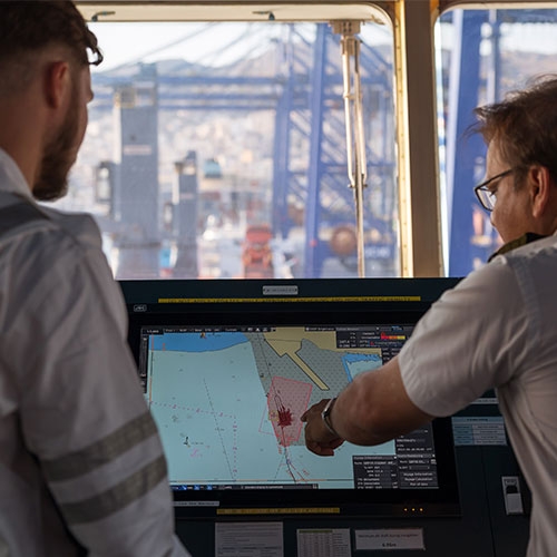
“Technology will keep evolving, but the most reliable defence against GNSS disruption is still a well-trained crew that knows what to do when the blue dot lies. GNSS should be treated as an assistant, not an authority: plan for its failure, rehearse those plans until they’re instinctive, and communicate early when things go wrong,” elaborated Rich.

According to the maritime security expert, bridge teams need to regularly drill loss-of-GNSS scenarios, recognising spoofing, switching fully to manual navigation, and using backup tools with confidence. Good seamanship, not technology, is what carries ships safely through uncertainty: “It is not all doom and gloom. If the industry combines sensible equipment choices with rigorous training and a culture of preparedness, then when satellites falter or deceive, crews will navigate by skill, teamwork, and judgment rather than by relying on a blinking blue icon. At BSM, we believe that regular drills and scenario-based exercises should make GNSS loss a well-practiced, not theoretical, event.”

From bustling ports to open oceans, GNSS disruptions can pose risks to maritime safety and efficiency. © BSM
Preparing for a shifting signal environment

Rich recommends operators to prepare accordingly, treating interference as a known risk within company frameworks and setting clear procedures for critical areas. Voyage plans should include built-in contingencies: alternate routes, manual navigation drills, and clear communication protocols to keep vessels safe when signals degrade. Network segmentation and verified software updates can also help contain risks: “At the same time, maintaining traditional navigation methods and using multiple satellite constellations, a combination of GPS, Galileo, GLONASS, or BeiDou, improve accuracy and guard against single-point failures. Long-term strength also comes from collaboration and smarter use of data. Fleets that share GNSS anomaly reports, cross-check AIS data with radar and satellite imagery, to flag inconsistencies can detect regional threats early and adapt with confidence.”

Technological innovation also offers hope. Research into spoofing detection, jamming mitigation, authenticated GNSS signals, and multi-source data integration is progressing rapidly, making systems smarter and more robust.

“The phenomenon of GNSS jamming and spoofing reflects how modern conflict and geopolitical competition are going beyond battlefields into the electromagnetic and informational realms. For the shipping industry, the challenge is real and growing but not insurmountable. Crew that know how to adapt can continue to operate vessels safely, even in waters where the signals are uncertain,” concludes Rich.

Nicholas Rich

Director of Fleet Management

Contact
DO YOU HAVE QUESTIONS?

Please contact our Director of Fleet Management at BSM.

RELATED BSM Highlights

Empowering seafarers for a multi-fuel future

As the maritime industry navigates its course toward lower emissions, a range of alternative fuels is reshaping how ships are powered. But the shift to new fuels is more than a technical change — it is a human one. Ensuring that seafarers are properly trained to handle, operate, and manage alternatively powered vessels is key to securing a smooth transition to the fuels of the future. Bernhard Schulte Shipmanagement prepares its crew to power tomorrow’s ships through comprehensive training programmes.

Is seafaring still attractive?

Since the steam engine era, society has progressed through the technological and digital revolutions. Today, Industry 4.0 offers near-limitless access to knowledge and a vast network of connected devices. Products or services seem only one click away. But as long as sci-fi ‘beaming’ technology remains fiction, maritime transport will continue to carry most goods, keeping seafarers at the heart of global trade. But is seafaring still attractive?